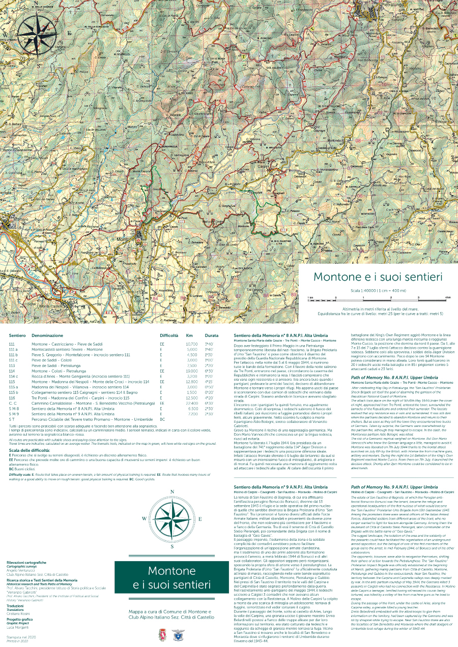
Map edited by the Municipality of Montone and the Italian Alpine Club Sez. Città di Castello.
We thank Angelo Venturucci for his collaboration.
All the routes can be practiced with suitable shoes and paying close attention to the signs. Travel times are indicative, calculated on an average walker. The thematic trails, indicated on the map in green, will have white-red signs on the ground.
For a better view of the map, it is advisable to print the files attached at the bottom of the page in A3 format


 And then Add to Home Screen.